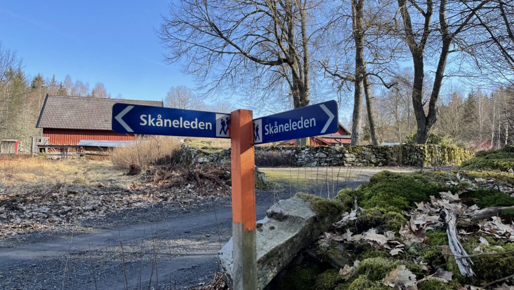
Did you know that a mere 2-hour train ride from Copenhagen will take you to some of the most beautiful forests Scandinavia has to offer? We are of course talking about of the forests of Skåne (or Scania in English), the Southern most part of Sweden. Here, a series of long-distance trails known as Skåneleden (literally “Scania Trails”) offer countless possibilities for stunning hiking experiences.
While the Skåneleden in Söderåsen (LINK) is a popular choice, we recently discovered this hidden gem of Skåneleden 1(SL1) or Coast to Coast Trail. The 370 km trail crosses Skåne from one coastline to the other, passing through deep mossy forests, countless blue lakes, and cute small villages. While the entire trek takes several weeks to complete, Sweden’s extensive public transportation system makes it easily possible to hike the trail in shorter sections.
This guide explains all you need to know about the 60 km long section of SL1 from Olofström to Osby. In our opinion, this stretchis one of the most beautiful part of the trail we have been on so far, and we are so excited to share it with you!
Note that this map is made solely for the purpose of giving an overview of the route. It is indicative of the route and is notmeant for navigational use.
What to Expect
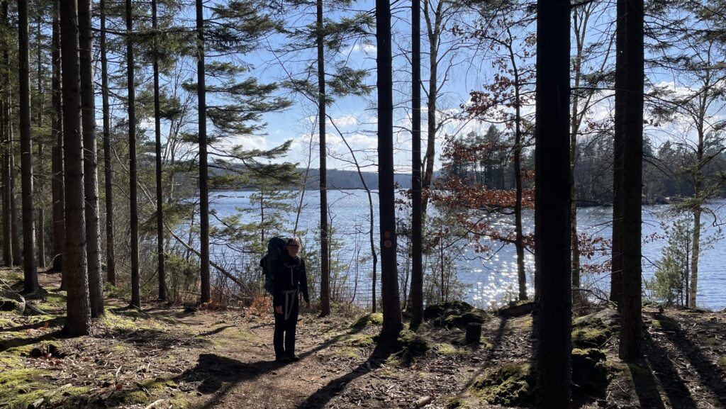
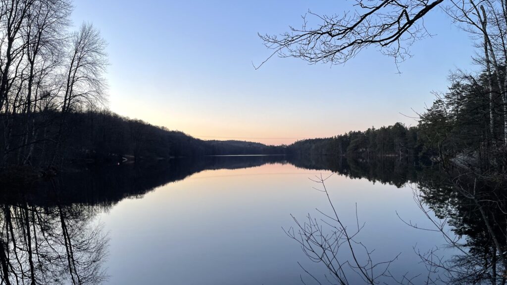
The beautiful landscape on this trail is definitely a highlight of this trek. For the most part, the trail passes through vast forests with tall trees and moss-covered forest floor. There are also several astonishingly blue lakes along the way to take a dip in if you like! Not only is nature beautiful here – you will also get to know the history of the area as you pass by old ruins of houses from the medieval age. As a great service, the municipality of Skåne has put up signs explaining what you are seeing.
How Difficult is the Trail?
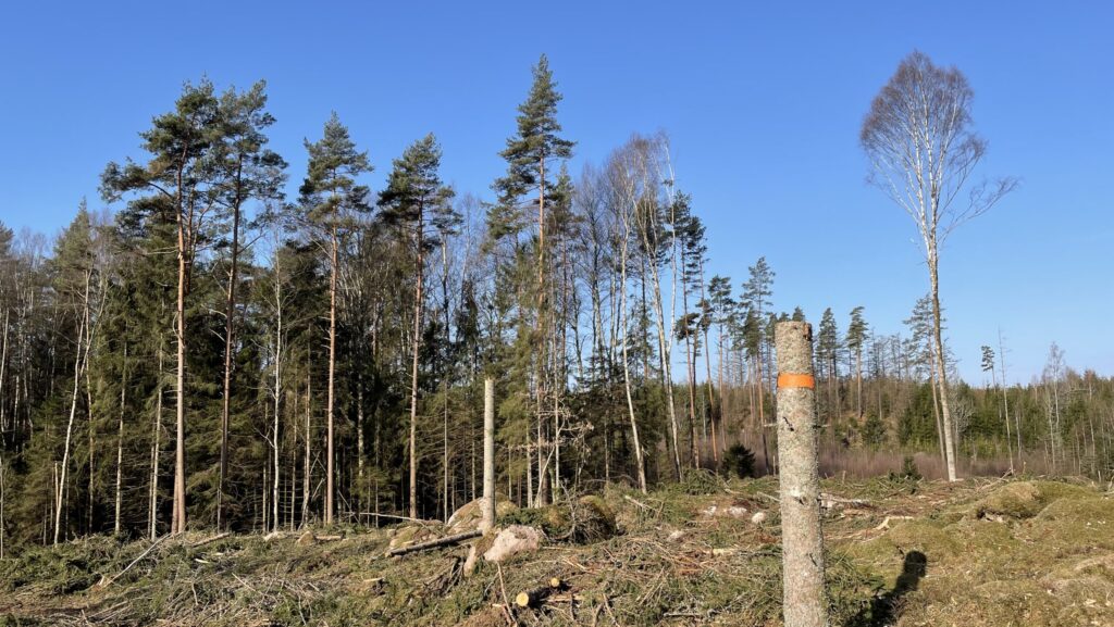
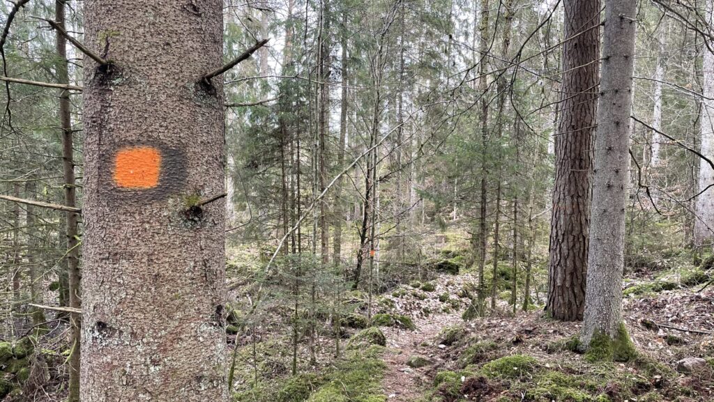
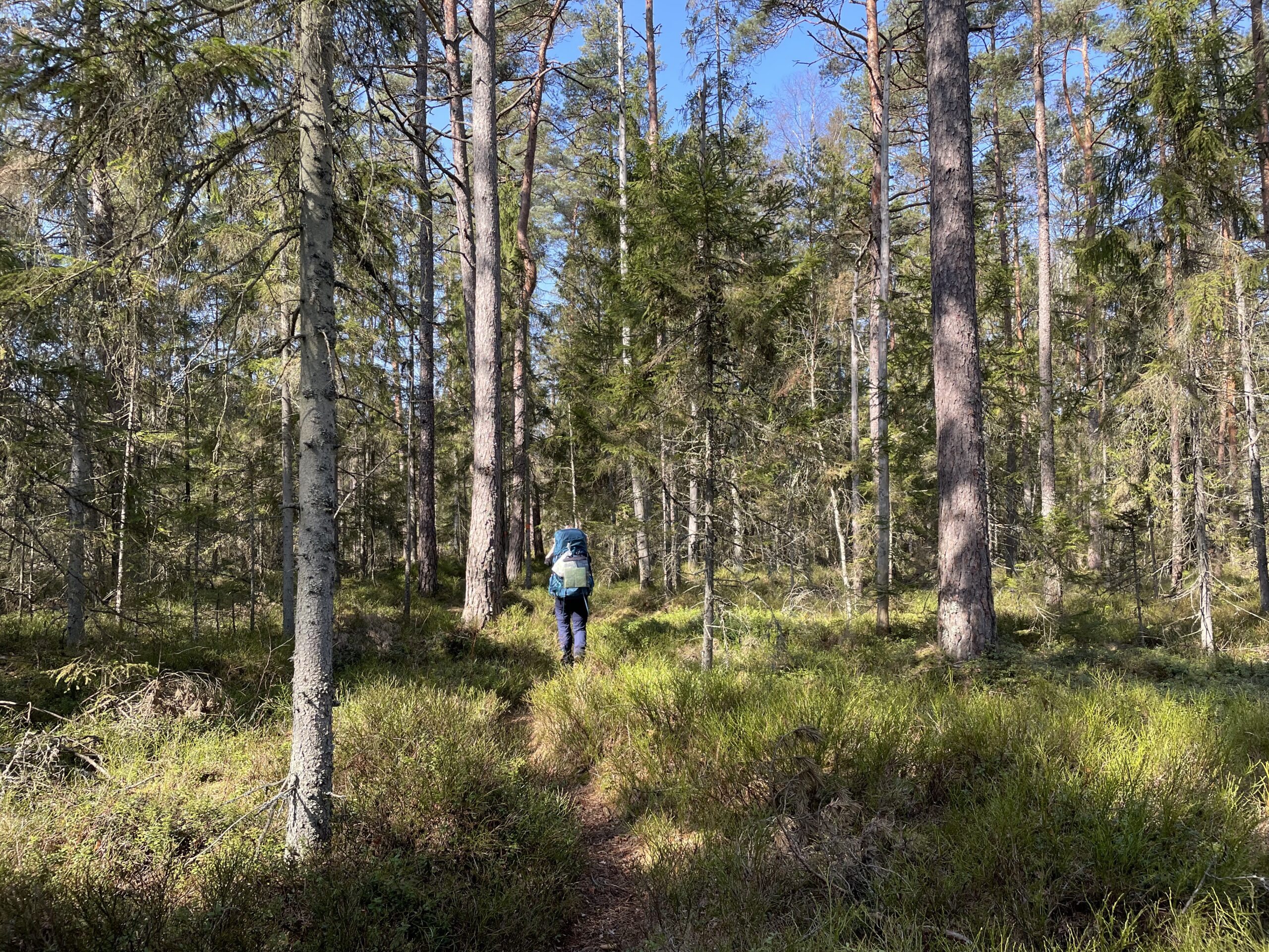
We consider this hike easy with some shorter moderate sections. The trail is mostly flat and alternates between narrow forest paths and broad tracks. There are several signs indicating the way, and the trek is well marked with orange poles and orange dots on trees, making it fairly easy to follow.
When to Hike
The trail is generally trekable in all year around. However, spring, summer, and autumn provides the best option for warm weather and low chance of precipitation.
If you decide to hike in winter, you should expect really cold weather (probably below freezing point) and pack plenty of warm clothes accordingly!
We went on this trip at the beginning of April, and we couldn’t have asked for better weather. On most days, the temperature reached 20°C, but nights were still a bit cold. We were grateful we brought our 3-season sleeping bags to keep us warm during the night!
Our Itinerary
We hiked the trail in 4 days (3 nights). The first and last day were short to fit in time for transport to and from the trail. On our first day, we took the train from Copenhagen in the morning and reached Olofström at noon. On the last day, we reached Osby in the early afternoon giving us plenty of time to make it back to Copenhagen on the same day.
Day 1: Olofström ➞ Bökestad (13 km, 4 hours)
Day 2: Bökestad ➞ Vesslarp (25 km, 8 hours)
Day 3: Vesslarp ➞ Glimåkra (19 km, 6 hours)
Day 4: Glimåkra ➞ Osby (17 km, 5 hours)
If you prefer to do the trek in more days, you can easily divide it into more sections.
Getting to the Trail and Back
The trail begins and ends in the two smallish towns, Olofström and Osby, respectively. Both are only a few hours drive from Copenhagen and can be reached by public transportation or car.
By Public Transportation
Copenhagen ➞ Olofström by Train + Bus
Coming from Copenhagen, you can take Øresundstoget (the Øresund Train) directly to Bromölla. From Bromölla, catch bus no. 561 to Olofström. The bus typically leaves every half hour, and the entire journey takes around 3½-4 hours.
Osby ➞ Copenhagen by Train
From Osby, Øresundstoget goes directly to Copenhagen. The train leaves once every hour and takes around 2 hours. If you don’t mind changing trains, trains leave frequently to Malmö from where you can change to a train to Copenhagen.
By Car
If you prefer driving to the trailhead, you can park your car in Olofström and take the bus from Osby to Olofström after you have finished the trek. From Osby, you have to take bus no. 539 to Lönsboda and change to bus no. 562 for Olofström.
Tip on Buying Train TicketsAn easy way to buy your train tickets is through the apps Skånetrafiken and Blekingetrafiken. Buy the tickets to Olofström in Blekingetrafiken, and tickets from Osby in Skånetrafiken.
The apps also contain train schedules, which is helpful for planning your journey!
Sleeping
One of the fantastic things about this trek is that it’s possible to sleep in free shelters or tent camp throughout the entire trail making for very affordable accommodation.
Sleeping in Shelter
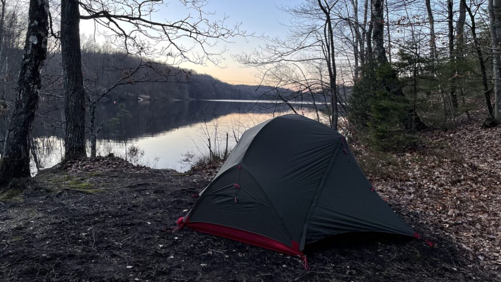
There are shelters at the end of each day but they cannot be booked beforehand. Whoever shows up first has the right to the shelter. This means that, even if you plan to use the shelters, you should bring a tent in case some of them are occupied (especially if you go during a public holiday or in the weekend). When we hiked during Easter Break, the shelters were already taken two nights out of three, and we were very grateful that we brought our tent.
The shelters typically allow space for 4 people to sleep comfortably. They don’t offer many facilities, but some of them have a small privy and a fire pit. There is also a water source nearby (but remember to treat your water before drinking it!).
Sleeping in Tent
In Sweden, they have this awesome law called the “Right of Public Access” (allemandsrätten in Swedish), which means that you are free to set up your tent almost anywhere you want. You just need to ensure that you are out of the vicinity of a house. This option gives you the freedom to make a stop for the day whenever you feel like it. You can also pinch your tent beside the shelters to make it easy to access water.
Drinking Water
Water is available at all shelters but should be treated before drinking. You can boil it, bring a water filter, or bring water purification tablets – if you want to know more about how the different ways to treat water, read our detailed guide (LINK).
The many lakes you will pass on the way are also a source of water. But same goes here: Remember to treat water from the lakes.
Just before the ascent to Glimåkra shelter, you will find a faucet with drinking water that does not need to be treated. It is placed on the outside of one of the buildings at Trollebadet.
Food and Resupply Options
Generally, there are not many possibilities for buying food on the trail. The expection is an ICA supermarket and a gas station in the town of Glimåkra. However, you will not pass Glimåkra town directly on the trail, so you would have to make a 4 km detour to reach the shops.
If possible, the easiest option is to carry your food for the entire trek. That way, you will not have to worry about finding a place to resupply.
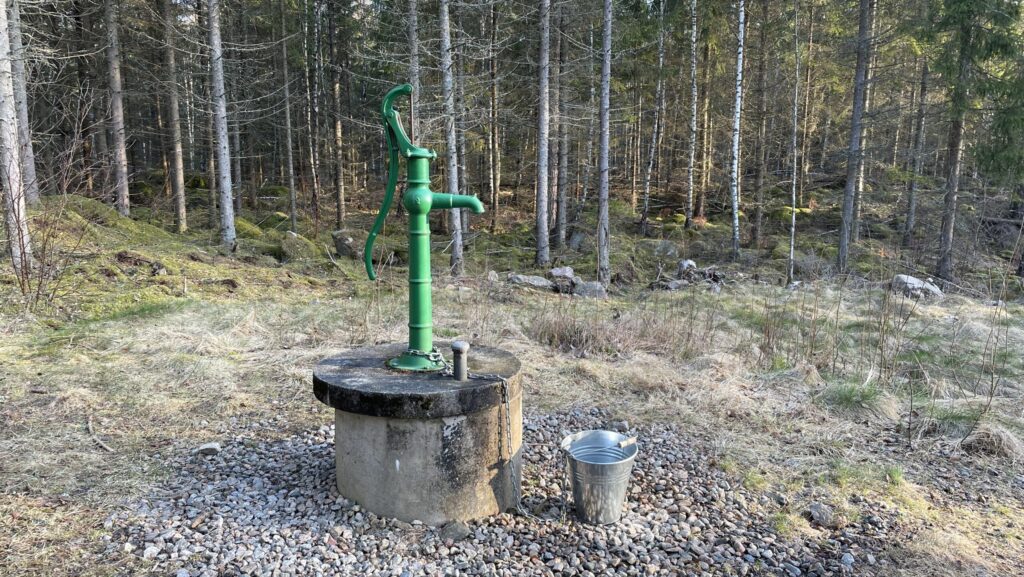
The water pump at Vesslarp offers easily accessible water (that has to be treated).
Navigating the Trail
The trail is well marked with orange poles and dots on trees, as well as signs throughout the trek. However, there are several other Skåneleden trails with the same markings that are easily confused with this trail.
We strongly encourage you to carry a physical map and a compass which you can buy on Sydsverige’s website. The map also contains shelters, facilities, and water sources.
Navigational Apps
You can also buy a digital map (GPX file) and use it to navigate through apps such as Maps.me, Guru Maps, and Gaia GPS. You will have to transfer the GPX file to your phone (LINK). Remember to also download the map of Skåne to make it available offline before you set off in case you don’t have signal on the entire trek.
The orange dots are sprayed on trees to mark the trail.
Beginning in Olofström, you will first have to pass through the outskirts of the town to reach the trail. From here, the path curves through dense forest with a thick layer of moss on the ground and tall coniferous trees reaching towards the sky. Coming from the busy city, it truly feels like entering a fairytale world. On this part of the trail, there are newly build shelters along the way (which are not yet marked on physical maps), making for great spots for a break right next to lakeHalen.
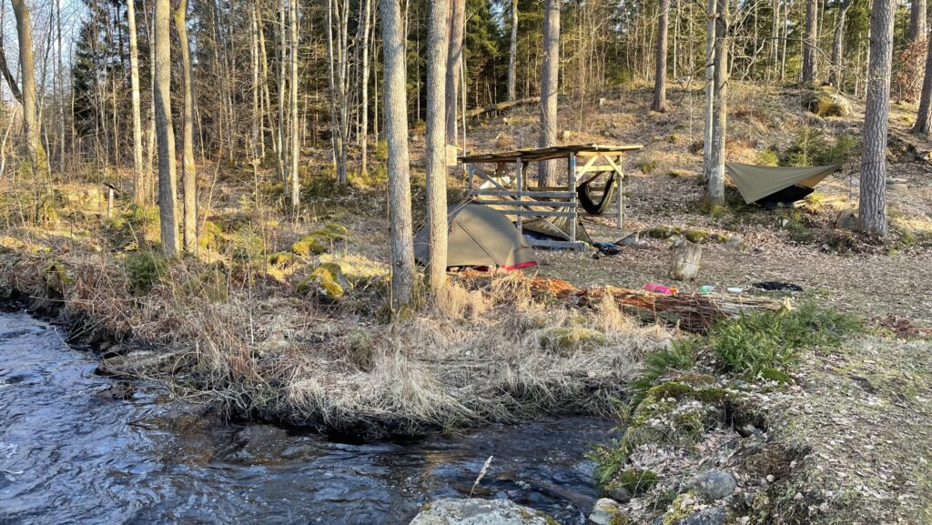
From here, the trail winds up and down and you will soon have to make a rather steep ascent towards a beautiful viewpoint of Halen. The whole area is very quiet and peaceful. Follow the narrow path passing by several lakes on your way to Bökestad. Here, you will find two shelters as well as plenty of space to set up a tent. Crossing the small wooden bridge will lead you to a pump from where you can fetch water (that has to be treated).
We were lucky to watch a beautiful sun set over the lake at Bökestad.
Day 2: Bökestad ➞ Vesslarp (8 hours)
From Bökestad, the trail runs north alongside the lake. About 3 km from Bökestad, you will reach another shelter right by lake Råslangen with amazing views over the lake. Curling through the forest and over several brooks, the trail continues towards the shelter at Brotorpet. The lake has a short section of sand shoreline and makes for a perfect place to go for a swim or have lunch.
Moving on, the narrow path continues to through moss-covered forest before reaching Vesslarp shelter. The shelter is beautifully placed atop a small hill by a river. On the other side, there is a simple privy, a water pump, and good space for setting up tents.
There is plenty of space to set up tents across from the shelter at Vesslarp.
Day 3: Vesslarp ➞ Glimåkra (19 km, 6 hours)
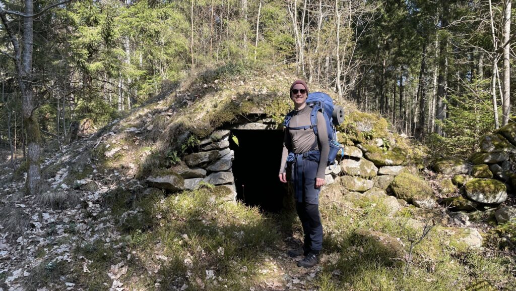
Today’s hike continues on a combination of small paths and broad tracks and the landscape is simply incredible. Going through the forest, you will reach Vesslarpssjön, another astounding lake for you to swim in if you like. The trail follows the lake and soon leads to a series of medieval ruins right along the path: You will see several houses built into the ground, as well as hills carved out for burning tar.
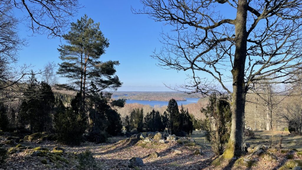
Continuing towards Glimåkra, you will reach Trollabadet, a large outdoor pool for the public to enjoy during the summer. Here, you can find drinkable tap water on the outside of the buildings right by the pool. If you need to resupply in Glimåkra, follow the road from Trollabadet south towards the town. Continuing on to Glimåkra shelter, the trail climbs steeply towards the top of a large hill with amazing views. There is one shelter and no water here, so make sure to stock up at Trollabadet.
There are many medieval ruins to explore on the way to Glimakrå.
Day 4: Glimåkra ➞ Osby (17 km, 5 hours)
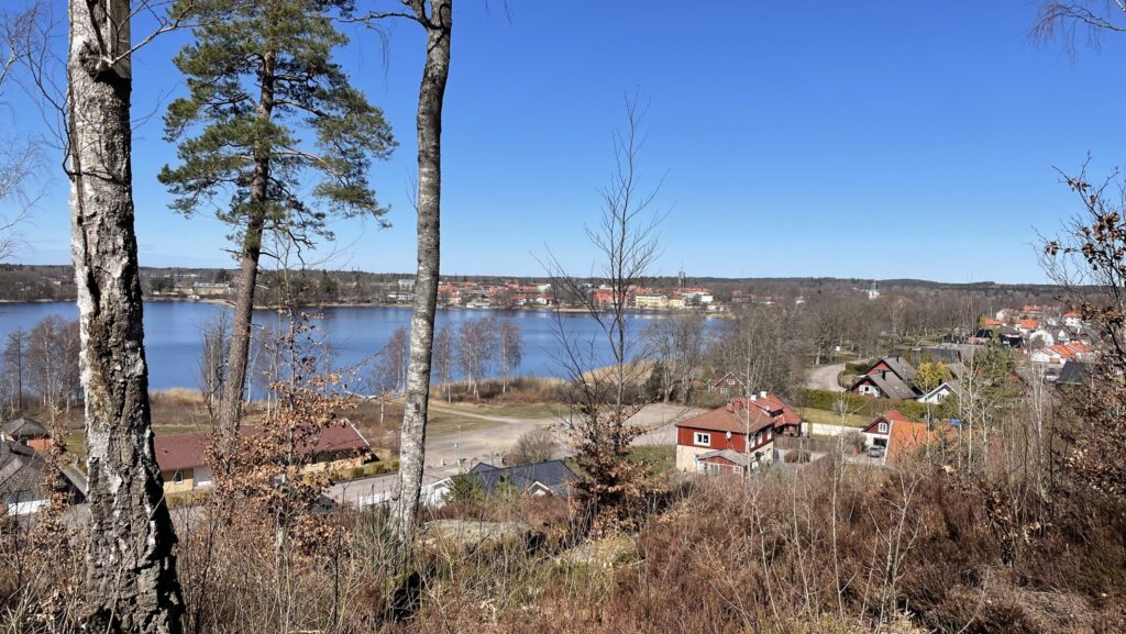
On the last day, the trail slowly approaches civilization and you will pass through several small villages on the way. Starting with a steep descent from Glimåkra Shelter, the trail continues on mainly broad tracks. There are many summer houses in this area, and the villages are very charming. There are no shelters and no water on this part of the trail until you reach Osby, so you must either carry water from Glimåkra or ask some of the local people for tap water. Nearing Osby, you will have amazing views of the town from above. Before getting to the center of the town, there is a shelter with water, privy, and firewood. You can make a stop here and eat your lunch or enjoy a well-deserved meal in one of the cafes in Osby before catching the train home.
Reaching Osby, you get to see the pretty town from high above.