Last year, we made a promise to each other to prioritize going on at least one overnight hiking trip together every month. That feeling of going on an adventure, experiencing a new place, and waking up in nature is so special to us and truly charges our batteries. When deciding on where to go, we often end up choosing Skåne, the Southernmost part of Sweden, due to the incredible nature and easily accessible trails here.
This time, we went on a 2-day hike from Båstad to Förslöv. The trek is a part of the 370 km long Skåneleden 1 (SL1), also known as the Coast to Coast Trail, crossing Skåne from East to West. Going through beautiful, old forests with plenty of shelters to sleep at along the way, this trek makes for the perfect weekend hike. Here, we have written down all you need to know before you go on this lovely hiking adventure!
Note that this map is made solely for the purpose of giving an overview of the route. It is indicative of the route and is notmeant for navigational use.
How Difficult is This Trek?
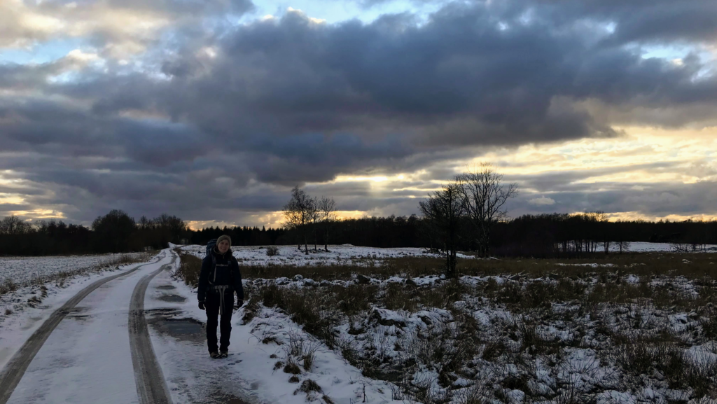
Overall, we consider this an easy hike on relatively flat terrain, mainly following broad tracks, roads, and some narrow forest paths. The trail is somewhat marked along the way with orange dots and signs, but know how to navigate is recommended.
When to Hike
With the right gear and experience, you can go on this hike all year around. If we had to choose, spring, summer, and autumn would be the best time of year due to more daylight hours, warm weather, and a lower chance of precipitation.
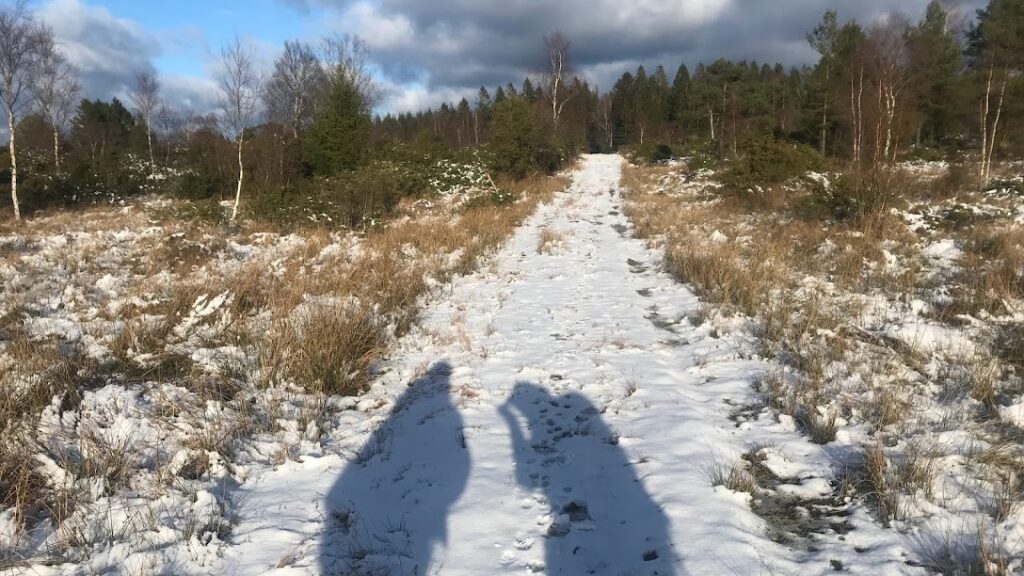
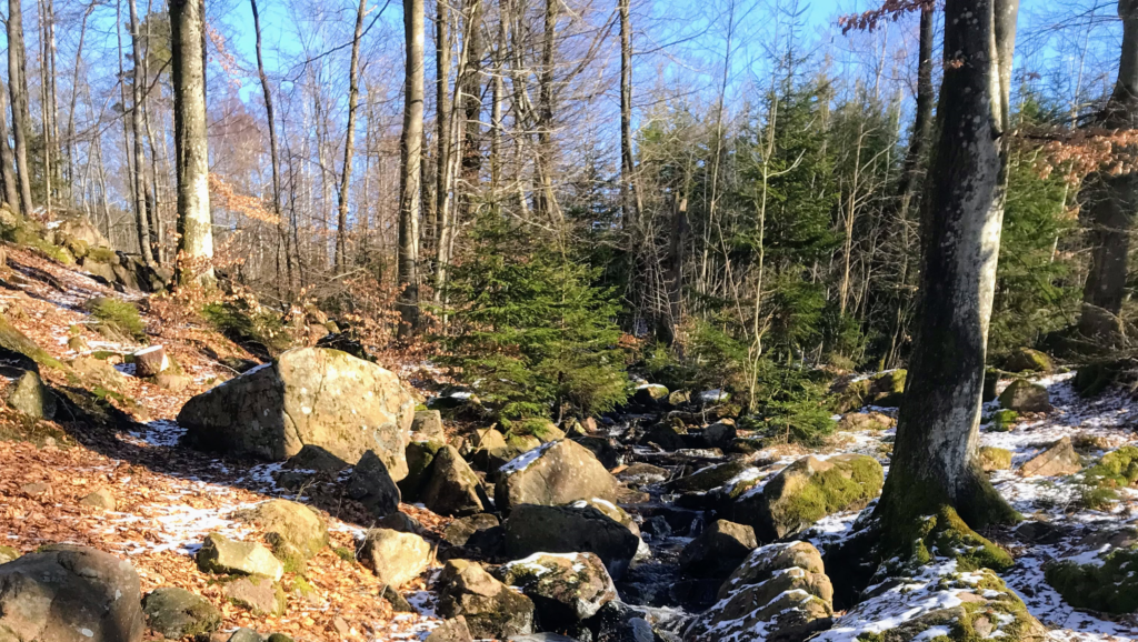
We went in February and with a fine layer of snow all around, we enjoyed the feeling of hiking in a winter wonderland. It was, however, really cold – especially at night when temperatures dropped several degrees below freezing point. To stay warm, we brought plenty of warm clothes and sleeping gear, and started a fire as soon as we reached the shelter. If you have the right gear, hiking in winter is a beautiful option.
There was still a bit of snow when we went in February 2023.
Our Itinerary
We hiked the trail in 2 days (1 nights) inclduing time to reach the trailhead on the first day and getting back to Copenhagen on the second.
The trail can easily be reached by both public transportation and car. Beginning in Båstad and ending in Förslöv, both towns are well connected to each other and to larger cities in Sweden by train.
By Public Transportation
Copenhagen ➞ Båstad by Train
Coming from Copenhagen, you can take Øresundstoget (the Øresund Train) directly to Båstad. The journey takes around 2 hours.
Förslöv ➞ Copenhagen by Train
From Förslöv, trains run frequently to Helsingborg from where you can either 1) Take the ferry to Helsingør and go to Copenhagen by train from here, 2) Take the Øresund Train directly from Helsingborg to Copenhagen, or 3) Take the fast train to Båstad (5 min) and take a direct Øresund Train to Copenhagen. The journey takes 2-3 hours depending on the timing of transfers.
TIPYou can easily check the train schedules and buy tickets on Skånetrafiken App.
By Car
If you prefer driving to the trailhead, you can park your car in Båstad and take the train back from Förslöv. The train runs often and will get you to Båstad in about 5 min.
Sleeping
Shelters
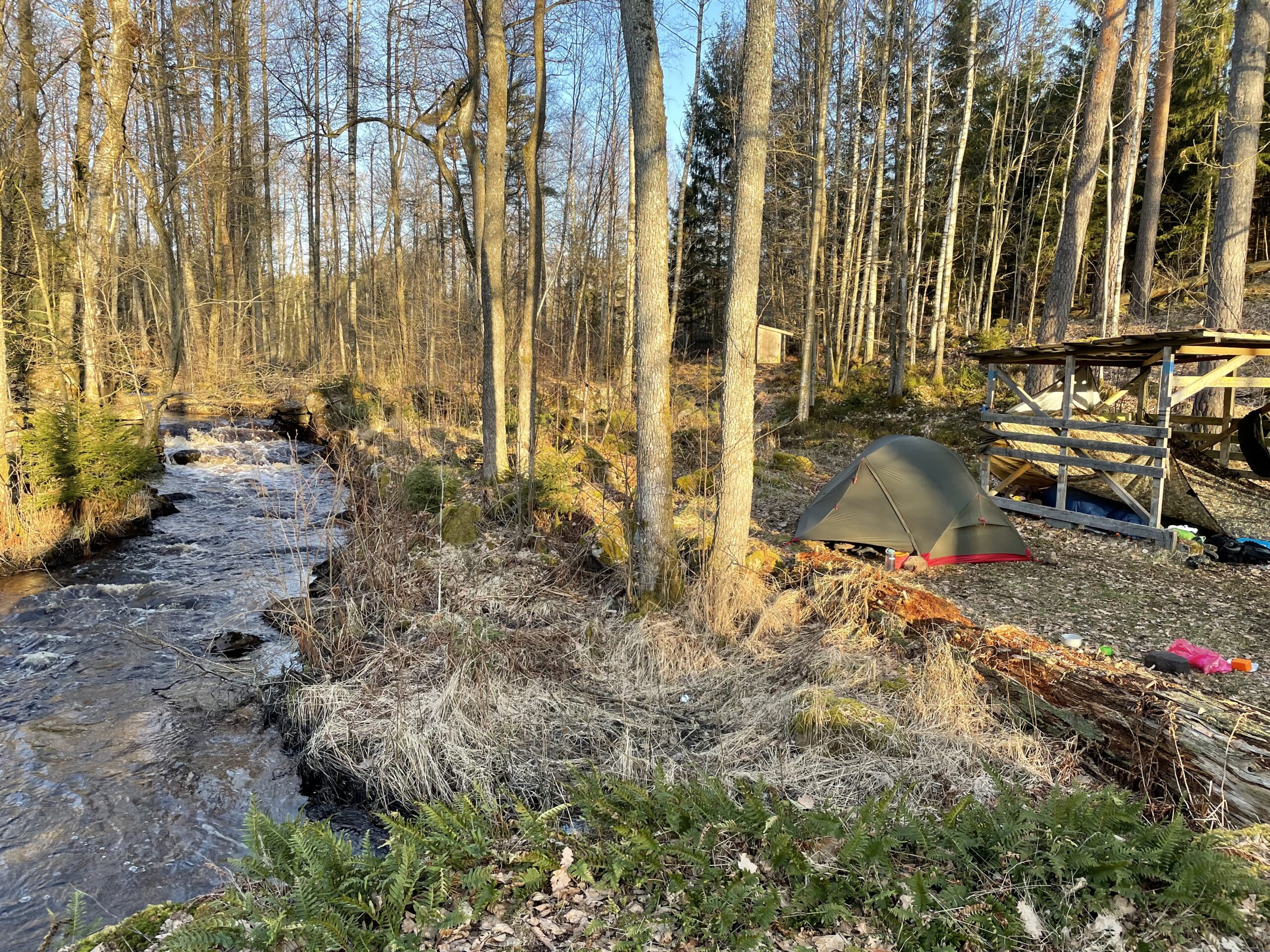
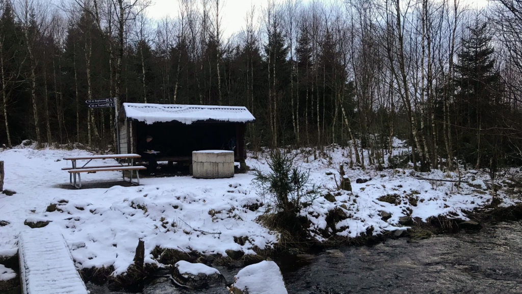
There are three shelters on the trail: One close to Båstad, one close to Förslöv, and one in Brammarp which is approximately halfway and the one we chose to stay at to divide the trail in two. All three shelters are placed in pretty locations with great facilities such as privies, fire places, fire wood and water nearby. Despite sitting close to the highway, Brammarp shelter is very cosy, and the brook running nearby provides a natural source of noise cancelling.
The shelters cannot be booked beforehand, and whoever shows up first has the right of access to it. If you plan to sleep in the shelter, you should bring a tent as a back up in case it is occupied when you arrive.
Tent Camping
If you prefer sleeping in a tent, the Swedish “Right of Public Access” (allemandsrätten) makes this a great option. Allemandsätten means that you are allowed to set up your tent anywhere you want as long as it is out of the vicinity of the nearby houses. Bringing a tent gives you the opportunity to camp whenever you feel like it. However, we noticed that the forest floor was quite uneven on the first day of our hike, so you might need to look for a while in order to find a flat place to set up camp.
Drinking Water
The shelters at Båstad and Förslöv both have a tap with drinking water, and Brammarp shelter is placed right at the side of a brook from where you can get water. Remember to treat it before drinking it so you do not risk getting sick!
You can also buy water at a gas station about 5 km before reaching Brammarp.
Note that if you hike during winter, the taps might be closed due to frost. But you can always get water from the gas station and from the rivers and brooks on the way.
Food and Resupply Options
It is possible to buy food, drinks, and some groceries at the gas station 5 km before Brammarp. The gas station also has a small restaurant attached. Other than that, there are no shops on the trail.
Navigating the Trail
The trail is fairly well marked with signs and orange poles and dots throughout the trek. You can buy a physical and/or digital map (GPX file) on Sydsverige.dk’s website. The map also shows the location of the shelters, their facilities, and water sources.
Navigational Apps
If you buy have a GPX file, you can use apps such as Maps.me, Guru Maps, and Gaia GPS to navigate. You will have to transfer the GPX file to your phone (LINK). Remember to also download the map of Skåne to make it available offline before you set off in case you don’t have signal on the entire trek.
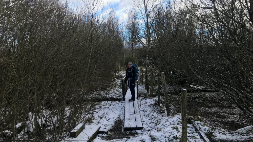
From Båstad station, you will have to follow the paved road until you reach the orange signs for the trail. Soon, the trail starts climbing the ridge next to Båstad making the town smaller the further you go up. Remember to look back once in a while, as you will have incredible views of the town and the nearby coast. Reaching the top of the ridge, the trail continues on paved roads for a few kilometers before turning right onto a small path. The landscape changes as you cross a swamp-like area on planks laid out to make walking easier. At the time we were there, the trail was covered in snow, and we had to be careful on the planks as they were quite slippery!
After about an hour of walking, the trail reaches the highway and a gas station. After crossing the highway, the path runs south through a coniferous forest for about 3-4 km before reaching Brammarp shelter.
Day 2: Brammarp ➞ Förslöv (13.5 km, 4 hours)
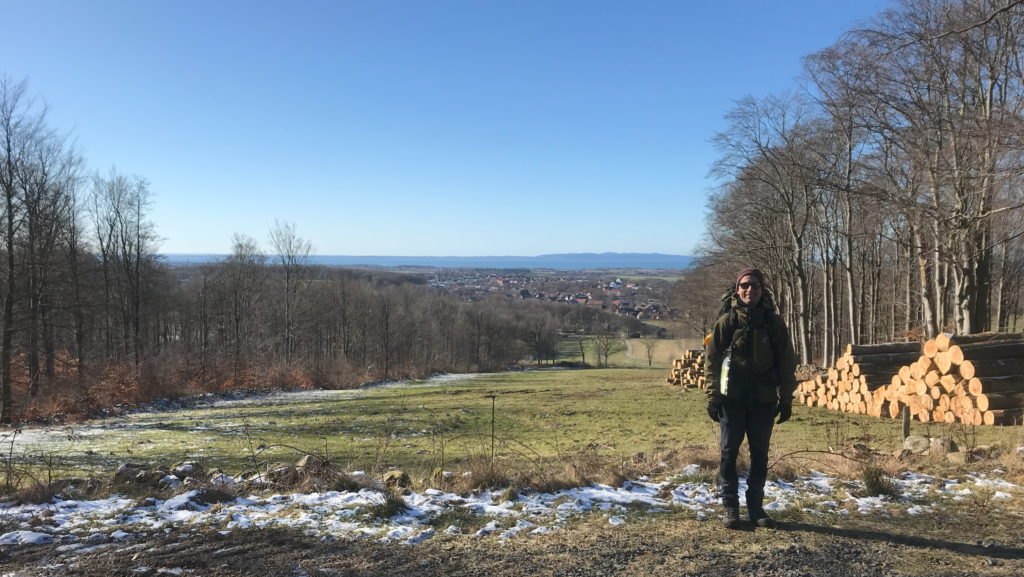
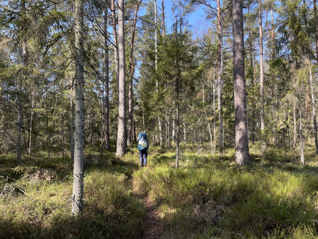
Compared to the yesterday, today’s route is spend on considerably less paved road, which we were very excited about. In fact, the trail runs through forests almost all the way to Förslöv. After a couple of hours walking, the trail reaches a particularly lovely part of the forest with dense trees and hanging branches that made us feel like we were so far away from the rest of the world. Soon, the forest cleared, and we were able to get stunning views of Förslöv from above as well as the coast in the horizon. From here, the trail starts descending steadily towards the town. Before we knew it, we reached Förslöv and walked through the town to find the train station. It is a very nice town to hang out in and made for the perfect place to end our trip.
Less popular trek, more quiet Shorter, easier than other treks in Nepal Amazing views Langtang Valley Trek: The Quick Stats Distance50-80 km Starting pointSyabrubesi Total…